According to a new report from a multinational academic group that studies the links between climate change and extreme weather events, an increasingly warm climate exacerbated the deluge of rain that fell on Kentucky and other states in early April.
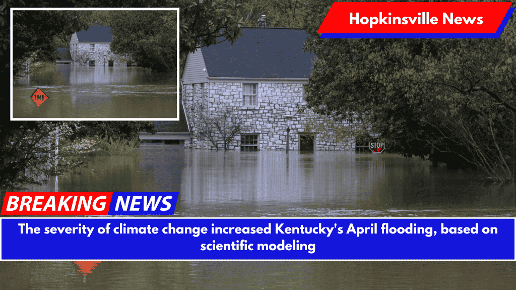
In early April, Kentucky experienced torrential downpours, with Western Kentucky receiving over a foot of rain in just four days. The Kentucky River in Frankfort and other waterways reached near-record levels, forcing residents to evacuate low-lying homes and businesses.

The storms caused dozens of counties to declare states of emergency, closed hundreds of roads, and killed seven Kentuckians, according to Gov. Andy Beshear’s statement.
According to World Weather Attribution, extreme rainfall in Kentucky and seven other states increased by 9% due to warming caused by fossil fuel use.
According to the report, climate change increased the likelihood of extreme rainfall, which drew moisture from a significantly hotter Gulf of Mexico, by about 40% over a cooler climate. The authors of the report discovered that such a rainfall event is still relatively rare, with a chance of occurring once every 100 years.

Bernadette Woods-Placky, a chief meteorologist at Climate Central, a New Jersey-based nonprofit research organization, said in a Wednesday briefing that it’s difficult to determine how climate change affected flooding in specific waterways and communities without studying the hydrology of each region.
However, she stated that even minor increases in flooding intensity can be significant when discussing a “tipping point” of whether a river crests a bank or barrier that is preventing it from flowing.
“If you reach that tipping point, it spills over into everything. As a result, even small changes in specific areas can have a significant impact,” Woods-Placky explained. “A warmer atmosphere causes more evaporation, so our atmosphere as a whole has more water to fall whenever there’s a trigger.

So that’s why we’re seeing an overall increase in heavy rain events.” Basil Griffin Park in Bowling Green remains inundated on April 7th, following days of heavy rain. (Austin Anthony photographed the Kentucky Lantern.)
Friederike Otto, an author of the report and a senior lecturer in climate science at Imperial College London, stated that while the methods used in the report were peer reviewed, the study on April rainfall had not yet been peer reviewed.
Based on modeling, the report predicts that if current global climate policies remain consistent, the climate will warm by about 2.6 degrees Celsius by 2100; in that case, extreme rainfall events “are expected to approximately double in likelihood again” and increase in intensity by an additional 7%.
In 2024, Earth experienced its hottest year on record, exceeding the 1.5°C warming threshold set by the 2015 Paris Climate Agreement.
Otto, the report’s author at Imperial College London, stated that significant increases in the likelihood of such weather events due to climate change could compound the costs of recovery in communities that have been repeatedly flooded.
If recovering from an extreme weather event costs billions of dollars, having it happen again may alter “what extreme weather can mean for a community.”
Those speaking on Wednesday also praised the National Weather Service’s preparedness and early warnings of impending weather across multiple states last month, saying it was critical in protecting people and property.
Woods-Placky advocated for the national agency after reports revealed that several NWS offices, including three in Kentucky, lacked a chief meteorologist to lead forecasting teams.
“They did some tremendous work, and they saved lives,” Woods-Placky said. On April 7, 2025, a dog walker pauses to photograph a flooded neighborhood street in Bowling Green. (Austin Anthony photographed the Kentucky Lantern.)


